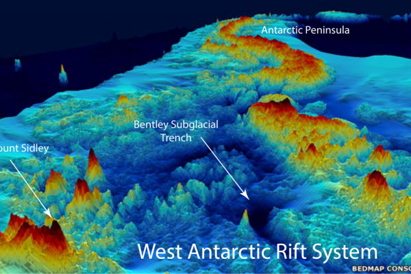
The geography of Antarctica’s underside
Scientists were able to deploy ruggidized seismometers that could withstand intense cold in Antarctica only recently. A line of seismometers strung across the West Antarctic Rift Valley and the Marie Byrd Land have given geologists their first good look at the mantle beneath the ice and rocks, revealing areas of hot rock that might affect the behavior of the overlying ice sheet.
Weighing the Antarctic ice sheet
The slow rebound of the bedrock as ice melts can be used to weigh the Antarctic ice sheet. Calibrating rebound will make it possible to measure how much mass the has lost since the ice sheets reached their maximum extent more than 20,000 years ago and how much it is currently losing. Two National Science Foundation grants will fund the installation of seismographs to calibrate crucial parts
of the Antarctic ice-weighing machine.