While NASA engineers and scientists determine how to roll the Spirit robotic rover onto the Martian surface, Raymond Arvidson, Ph.D., McDonnell Distinguished University Professor and chair of Earth and Planetary Sciences in Arts & Sciences and a host of Washington University personnel are doing their part for a successful mission.
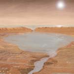
Arvidson is the mission’s deputy principal scientist. He and his collaborators already made important contributions to determining the safe landing of Spirit as well as the landing site of Opportunity, set for Jan. 25 on the Meridiani Planum. The plains show evidence of an iron oxide mineral called hematite that may have formed in old lakebeds, or the deposits could consist of a layer within a thick set of volcanic deposits that has been hydrothermally altered. Either way, the landscape looks ripe with the possibility of ancient hydrological evidence.
Spirit landed safely with much fanfare on the floor of Gusev Crater on Jan. 3, and has taken many stunning pictures of the Red Planet. Both landing sites are situated near the equator, a necessary position for the two solar-powered rovers.
Spirit’s first photos indicate that if the landing site was ever a lakebed, it has been significantly altered by other geologic processes. What they might have been remains the subject of intense debate among mission scientists.
According to Arvidson, the Gusev plains seem to have formed via a number of processes.
“There is evidence for wind erosion and deposition, cratering, and the blocks look like fragments of lava flows,” he said. “Any lake deposits have probably been buried and our job is to command Spirit to rove across the surface and find any evidence for lake sediments in among the rocks and soils. For example, the deposits may have been excavated during cratering and deposited on the surface as ejecta. The more important job is to understand how the surface formed and evolved over time, including the role of water — lake water, hydrothermal water, thin films of water on grains, for example — and implications for past conditions and the habitability of Mars. This is the essence of science and the scientific method, generating hypotheses, testing the hypotheses with data, updating ideas, and finally, coming to conclusions about the origin and evolution of the landforms and materials at the Columbia Memorial Station site, including the role of water. ”
Washington University faculty, students and staff, all in Arts & Sciences, and members of the earth and planetary science department, working with the Athena Science Payload team are: undergraduate student and Rhodes Scholar Bethany Ehlmann, earth and planetary sciences doctoral candidate Frank Seelos, Larry Haskin, Ph.D., professor; Bradley Jollif, Ph.D., research associate professor; Alian Wang, Ph.D., senior research scientist; Ed Guiness, senior research scientist; Tom Stein, computer systems manager; and Margo Mueller, assistant to Arvidson.
“We are all part of the Science Working Group (SOWG) charged with planning observations and interpreting the data,” said Arvidson. “Brad also has a special role as a documentarian, making sure that the scientific deliberations are recorded and archived.”
Once the rovers get on the Martian surface, they will immediately begin collecting data. Panoramic cameras will provide a 360-degree view of the surface, as well as help determine sites for closer inspection. A rock abrasion tool sits on the end of a long arm and is used to expose the unaltered interiors of rocks.
Another instrument, known as “mini-TES” (thermal emission spectrometer), will scan the scene in infrared to help identify regions where water may have interacted with the surface. Similarly, the Moessbauer spectrometer will be used to identify rocks containing iron and determine what role water may have played in that mineral’s formation.
An alpha particle X-ray spectrometer will measure elements in the rocks and soil, and a microscopic imager will look at fine-scale features of rocks and sediment deposited by water.
The information will be relayed back to Earth in one of two ways. The “direct to Earth” antenna is a high-gain transmitter that both sends and receives data. Another antenna, called a “dipole,” communicates with Mars Global Surveyor and Odyssey. The orbiters have much more powerful antennas and can transmit data to Earth more quickly.
“We are focusing on acquiring color images and emission spectra (Pancam and Mini-TES) of the landforms surrounding the lander, together with turning on and checking out the Moessbauer Spectrometer, Alpha Particle X-Ray Spectrometer, and Microscopic Imager on the Instrument Deployment Device, ” Arvidson said. “We are also imaging the magnets to evaluate if wind blown dust is accumulating. The imaging and spectral data are being used to characterize the landforms and rocks/soils at the site and to plan traverses and measurements once we are on the surface and roving.”