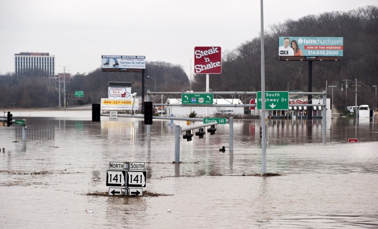
Intersection of Interstate 44 and Route 141 in St. Louis County, Mo., on Dec. 30, 2015. Water levels more than 4 feet higher than previous record floods closed a 20-mile stretch of the highway. (Photo: © Sid Hastings)
At the end of December 2015, a huge storm named “Goliath” dumped 9-10 inches of rain in a belt across the central United States, centered just southwest of St. Louis, most of it in a three-day downpour.
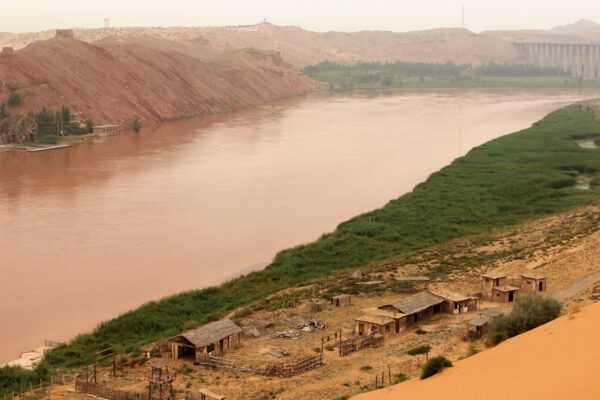
The rain blanketed the Meramec Basin, an area of 4,000 square miles drained by the Meramec River, which enters the Mississippi River south of St. Louis.

The Meramec’s response was dramatic. Gauging stations recorded a pulse of water that grew as it traveled down the main stem of the Meramec River, setting all-time record highs in the lower basin in the Missouri cities of Eureka, Valley Park and Arnold.
While extraordinary rain drenched the entire Meramec Basin, only 5 percent of the Mississippi River’s giant watershed above St. Louis was so affected. Yet only a day after the flood on the lower Meramec peaked, water levels on the Mississippi at St. Louis were the third-highest ever recorded. A few days later, record flood stages were recorded downstream at Cape Girardeau, Mo., and Thebes, Ill.
Why was the flooding so bad? Most news reports blamed it on the heavy rain, but Robert Criss, PhD, professor of earth and planetary sciences in Arts & Sciences at Washington University in St. Louis, said there was more to the flood than the rain.
“I think there was significant magnification of the flood levels on the Meramec by recent developments near the river,” he said. “Sure it rained a lot, but what happened here cannot be explained by the rainfall alone.”
The flood on the middle Mississippi River, in turn, was remarkable for its short duration and the time of year. “It was essentially a winter flash flood on a continental-scale river,” Criss said. “The Mississippi has been so channelized and leveed close to St. Louis that it now responds like a much smaller river.”
In the February issue of the Journal of Earth Science, Criss and visiting scholar Mingming Luo of the China University of Geosciences in Wuhan, China, take a close look at data for the New Year’s flood, treating it as a giant natural experiment that allowed them to test their understanding of changing river dynamics.
“Flooding is becoming more chaotic and unpredictable, more frequent and more severe,” Criss said. “Additional changes to this overbuilt river system will only aggravate flooding.
“In the meantime,” he said, “inaccurate Federal Emergency Management Agency flood frequencies based on the assumption that today’s river will behave as it has in the past greatly underestimate our real flood risk and lead to inappropriate development in floodways and floodplains.”
What happened at Valley Park and why?
The prior flood of record in most of the lower Meramec Basin occurred on Dec. 6, 1982, Criss said. Given that the 1982 flood, like the 2015 flood, was a winter flood during an El Niño event, they should have been similar. Criss thought it would be revealing to compare them.
When he did this, he discovered that the peak flood stage at Valley Park in 2015 was three-feet higher than it would have been had the river responded as it had in 1982, and more than a foot higher upstream from Valley Park at Eureka in 2015 than in 1982.
What had happened at Valley Park between 1982 and 2015? A three-mile-long levee had been built next to the river; a landfill partly in the river’s floodway (as defined in 1995) had expanded; parts of the floodplain had been built up with construction fill; and development along three small tributaries of the Meramec had destroyed riparian borders, so that they became torrents after a rain but no longer flowed continuously.


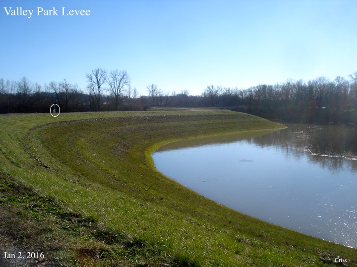
The record high water levels on the Meramec were associated with these developments, Criss said. “The biggest jump in the flood stage was next to the landfill in the floodway and to the new levee, which restricted the effective width of the floodway and ‘100-year’ floodplain by as much as 65 percent.”

The long-term flood record also supports his case. The flood stages at Valley Park have recently increased compared to those at Eureka, Criss said. Of the eight great floods that have occurred on the Meramec since 1915, the flood stage at Valley Park was anomalously high relative to the other gauging stations in only 2008 and 2015, the two floods after the levee was built in 2005.
The Mississippi River’s flashy response
A day after the peak flooding on the lower Meramec, water levels on the Mississippi at St. Louis were the third-highest ever recorded. But what made this flood remarkable, said Criss, was not the records it set but rather its short duration and the winter timing.
The Mississippi was above flood stage for only 11 days in January 2016, compared to 104 days in the record flood of 1993 and 77 days for the flood of 1973, the next biggest flood.
The Mississippi should just have swallowed this storm, Criss said. “Instead, this huge continental-scale river exhibited the flashy response typical of a river 100 times smaller.
“Why? Because we’ve made a small river out of a big river,” Criss said. The river channel is only half as wide as it was when Robert E. Lee mapped the St. Louis harbor in 1837, and it is full of thousands and thousands of wing dikes and other obstructions.”
Underestimating the risk
“We have gauge records for downtown St. Louis every day, going back to the Civil War,” Criss said, “but we are mistaken if we think we can base predictions of flood frequencies on averages over that period because the river today is not the river it was a century ago.

He drives home the point by breaking the flood data into two chunks and looking at the earlier half separately from the later half. When he does this, it becomes apparent the river is becoming more chaotic and unpredictable and that floods are more frequent, higher and more damaging than they once were.
As the New Year’s flood demonstrates, when we assume an unchanging river, we greatly underestimate our flood risk, he said. “The St. Louis levees protected us from the 1993 flood, considered a 330-year event,” he said. “But if a real ‘200-year’ flood occurred on today’s river, the structures protecting St. Louis would be overtopped.
“The heavy rainfall was probably related to El Niño, and possibly intensified by global warming. But new records were set only in areas that have undergone intense development, which is known to magnify floods and shorten their timescales.
“People want to blame the rain, but this is mostly us,” Criss said. “It’s a manmade disaster.”
During the New Year’s flood, roughly 7,000 buildings near St. Louis were damaged, two interstate highways were closed for several days, the community of Valley Park was evacuated, and two Metropolitan Sewer District plants were swamped so that sewage was dumped directly into the water. The flood killed more than 20 people in Missouri and Illinois, caused several hundred million dollars of damage, and left millions of tons of debris in its wake.