Jordan Neeley, a junior studying environmental earth science at Washington University in St. Louis, once asked the same question that many visitors ask: What is a shut-in?
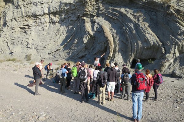
Rock formations called shut-ins confine a section of a river, forcing water to flow between the steep walls of a canyon or gorge. Shut-ins are found in streams and rivers across the Ozarks. But some of the most outstanding shut-ins in the state are located at Johnson’s Shut-Ins State Park, where Neeley is studying bedrock river erosion.

Neeley is attending the American Geophysical Union (AGU) fall meeting in New Orleans in December to present her research. Every year, the AGU fall meeting convenes more than 25,000 attendees from 100-plus countries to share research and network.
“The main goal of our work is to contribute more information about bedrock rivers,” Neeley said, pointing out these are the kind of rivers that run over exposed rock with limited amounts of sediment blanketing their bed and banks.
Neeley is conducting her research with Claire Masteller, assistant professor of earth and planetary sciences in Arts & Sciences.
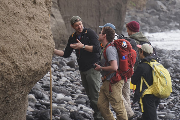
Neeley first visited Johnson’s Shut-Ins State Park, located about two hours southwest of the Danforth Campus, as a freshman fellow in the university’s Pathfinder for Environmental Leadership program. This year, with support from the university’s Office of Undergraduate Research, she spent a few weeks in the summer wading through the park’s spectacular chutes and waterfalls at the east fork of the Black River.
“A rock face that’s facing upstream, which is getting more erosion, behaves differently than a face that’s facing downstream,” Neeley said. “The downstream face isn’t getting the direct impact of other rocks and the direct impact of water all of the time. All of those different factors can determine erosion.”
River rocks take a beating
Neeley started her research by taking literally thousands of photographs of the blocky rocks in the main channel of the shut-ins area.

Neeley and Masteller are using these photos — combined with Neeley’s seismic wave velocity measurements and topographic data generated by a LiDAR drone — to observe and measure the effects of different erosive processes at Johnson’s Shut-Ins.
Whether through abrasion or by ‘plucking’ — when chunks of rock get washed or scraped away from a larger rock surface — river rocks face a constant beating. And erosion has an impact on rock surface strength.
“Bedrock rivers are like the skeletons of the landscapes we look at.”
Claire Masteller
“By measuring how rock strength is affected by water movement, my data can contribute to the understanding of how rivers may react to flooding events that are becoming more destructive as a consequence of climate change,” Neeley said.
“Bedrock rivers are like the skeletons of the landscapes we look at,” Masteller said. “We try to look at their shape to say what happened in terms of long-term tectonics, how climate has changed and what the surface has experienced in the past.
“Here, we really wanted to hammer into the mechanics of how erosion actually works in these rivers — and how that affects how they look, how they’re shaped and how they might adjust their slopes or their width over time — as a function of erosion, or the river’s ability to continue cutting down through the bedrock,” she said.
Neeley learned how to use tools like MATLAB to process and present the data and images that she collected along the river.

Gathering and then working with geospatial data from the drone was one of the most exciting aspects of this research effort for both Neeley and Masteller.
“St. Louis is starting to become a hub for geospatial startups,” Masteller said. “For this project, we got a grant to work with a local geospatial company called InfraLytiks to develop methods for feature detection of fractures.”
With drone-based LiDAR, the scientists were able to collect topographic data at centimeter-scale resolution.
“Jordan is using industry-standard tools to do her point-cloud analysis,” Masteller said. “Whether or not she wants to continue in the earth sciences after she leaves WashU, she has a lot of data analysis experience with tools that people are actually using.”
The researchers plan to continue to go back to Johnson’s Shut-Ins in the coming years.
“We can keep going back and flying the LiDAR drone and taking these fine-scale measurements, like what Jordan has done, to look at how the river erodes in real time,” Masteller said. “With change detection and repeat surveys of this reach, we can get a much better sense of how it’s eroding.”